


The worst of Delhi’s toxic winter haze may not be at ground level – but 100 metres above it, according to a new study using drone-mounted sensors.
The drones uncovered a startling vertical dimension to the city’s air pollution crisis, with PM2.5 concentrations 60% higher at altitude than on the ground.
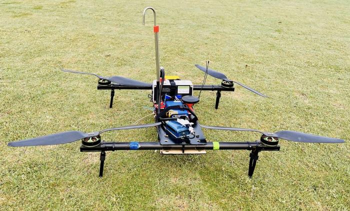
Drone with payload suite of measurement sensors used to detect particle matter
The research provides the first detailed vertical profiling of post-winter haze in the Indian capital. On severe haze mornings, the team recorded PM2.5 levels reaching 160 µg/m³ at 100 metres, far exceeding India’s already-lenient national standards.
Lead author Dr Ajit Ahlawat of Delft University of Technology said: ‘The vertical profiles revealed a distinct layering of pollution that ground monitors simply cannot see. During hazy mornings, a shallow, stable boundary layer traps pollutants close to the surface, but concentrations actually peak well above ground level.’
Using a custom-built drone platform equipped with modified low-cost particulate sensors, the team overcame two persistent challenges in aerial monitoring: rotor downwash interfering with sampling, and humidity skewing readings. A 36cm sampling inlet and silica-gel dehumidifier improved measurement accuracy by over 40%.
Ahlawat explained: ‘One significant advancement was the design of a customised vertical aerosol sampling inlet, positioned approximately 30cm above the drone’s rotor blades. This design minimises particle loss caused by rotor turbulence. Another challenge was the high humidity, a meteorological factor that is not particularly rare in the region. As air sampling struggles in such conditions, a custom designed silica-gel dehumidifier was connected to the sampling tube to ensure reliable results.’
The study also sheds new light on what drives Delhi’s notorious morning haze. Ground-based chemical analysis revealed dramatic overnight spikes in chloride – jumping from 2 to 8 µg/m³ by dawn – coinciding with high humidity and suppressed boundary layer heights below 200 metres. This points to the part played by ‘hygroscopic’ inorganic aerosols, which absorb water from Delhi’s humid, early morning air, growing in size and diminishing visibility.
Furthermore, once they become liquid or semi-liquid, they can undergo chemical reactions more readily, forming even more pollution in a feedback loop that worsens the haze.
Perhaps most significantly, the drone data exposed serious deficiencies in the models used to forecast Delhi’s air quality. When compared against real-world vertical measurements, the widely-used WRF-Chem model underestimated PM2.5 by more than 50% during hazy mornings – a bias strongly correlated with its failure to capture near-surface humidity. During non-hazy conditions, model error dropped to just 10%.
co-author Sherin Hassan Bran of Thailand’s National Astronomical Research Institute. said: ‘This persistent dry bias means models cannot simulate aerosol hygroscopic growth. They’re missing the fundamental physical processes driving haze formation.’
By comparing the amount PM1 to PM2.5, the researchers could tell whether the pollution was freshly emitted or had formed and aged in the air. During severe haze, this ratio dropped at higher altitudes, a sign that the pollution hanging over the city was older, chemically transformed, and had swollen with moisture.
Ahlawat concluded: ‘I am delighted to say that measuring vertical profiles with low-cost air quality sensors is working, and the methods are openly accessible. This will enable people in megacities to develop better haze forecasting and warning systems and provide valuable insights into identifying pollution at vertical levels.’
The full research can be read here.
Drone photo: Ajit Ahlawat
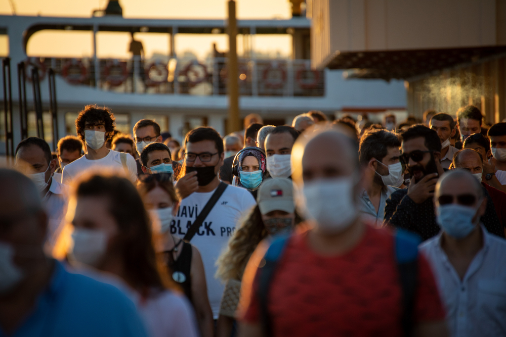
Delhi photo: Saakshi Yadav / Pexels
Leave a Reply