


Priscilla Castro, Communications Officer, and Alis-Daniela Torres, Sustainable Resources Senior Officer, both from ICLEI Europe, explain how citizens can keep updated on pollution levels and make choices to benefit their health by using the new Naonair app.
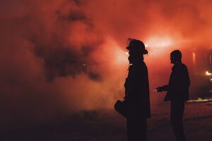
An average adult breathes 20 kilograms of air per day. That is 20,000 times breathing in and out to move air through the human body. Although invisible, the quality of this air impacts mental and physical health, and exposure to air pollution is an increasing concern for the population. In the French Metropole of Nantes, real-time geolocated data on pollution levels help citizens make informed daily decisions.
Using existing data on weather, background pollution and real-time traffic, a mobile application developed by French non-profit organisation Air Pays de la Loire provides live data on different air pollutants (namely on PM10, PM2.5, ozone, nitrogen dioxide and sulphur dioxide) to guide users on healthier ways to move and live. Launched on 23 September, the Naonair app is a product of the Aireal project, financed by the ICLEI Action Fund, a granting scheme led by ICLEI – Local Governments for Sustainability with support from Google.org.
The app supports pedestrians and bikers who need to commute or wish to stroll or relax outdoors. Users can navigate the interface to self-locate and move around the map to see the air quality in the metropolitan area. Pollutant levels are represented by a graded colour scale, ranging from green (good) to purple (extremely bad); the application provides users with both ‘healthier’ and ‘faster’ route options. In addition, it is possible to check the air quality at emblematic places in the city, such as cultural places, sports venues, local parks, etc.
‘Providing science-based and real-time traffic and air pollution information to citizens is key to allow them to understand the state of the environmental condition, encourage choosing sustainable mobility alternatives, and raise awareness for interventions by public authorities to accelerate action, ensuring healthy living conditions in cities,’ said Deputy Regional Director of ICLEI Europe, Holger Robrecht.
Climate, transport and environmental data take centre stage in the application’s two-fold approach: making the population aware of air pollution, and enabling data-driven decision-making and measure implementation. Access to information can be leveraged for better decisions, allowing citizens to take action by choosing itineraries or destinations based on the data, and informing local authorities about key air pollution issues and hot spots.
‘I am always outdoors going to work or walking my dog and my kid, who is right there at the same height as the car pollution, so it will be useful to know how much we are exposing ourselves to that,’ said resident Solene Rocher. For sportspeople, the availability of real-time information can increase the quality of the workout. ‘We need to choose the better route so we can adapt the intensity of the workout according to the data we see,’ said cyclist Daniel Daoulas.
Methodology
Building real-time air quality data requires calculations that draw on different data sources. Air Pays de la Loire experts created a model to build a detailed map by turning data on weather, greenhouse gas emissions, background pollution (coming from other countries or other parts of France), street shape, and traffic from 700 counting stations into emissions data and, finally, into data on the concentration of the five air pollutants to show users the air quality of a chosen itinerary in real time.
‘To build real-time itineraries for a real-time problem like ours, we need this type of data, and we cannot use general global data and propose routes because it will be different between morning and afternoon. If we want to make precise solutions, we have to have precise data. But before building new data, we have to understand and properly use the data that is already there,’ project manager Camille Magnan said.
Before the public launch, 30 beta testers used the application over the summer, and reported their feedback back to the development team. ‘It is like Google Maps to get around town with the added benefit of knowing the air quality and what you breathe when you go out on different streets because obviously, you cannot see it, but now you know that it is there,’ said Laureen James, beta-tester.

Urban experimentation
With support from Nantes Metropole and the local innovation lab Samoa, Air Pays de La Loire implemented the Aireal project in three main steps: the design of a tool with territorial and existing data; the implementation of urban experiments; and, finally, the development of the application.
Samoa – who were responsible for testing the approach in public space and the applicability of the model developed – installed an urban experiment in the “Île de Nantes” area, aimed at making air quality a concrete subject in everyday life. Connected visual panels were installed on the Anne de Bretagne bridge in the centre of Nantes, which informed drivers, cyclists and pedestrians about the air quality at that location in real time. Based on local air information, citizens could adapt their behaviour and routes to reduce exposure to pollution. The experiment was ongoing from May to September 2022, and Samoa will now conduct analysis to check its impact on people’s behaviour.
For Hugues du Puy, project Manager at Samoa, the first step is to raise awareness, to put the information out there. ‘Secondly, we need to launch a map of the island to improve the quality of the air at street level, with granularity. So far, we have noticed that people do see the problem but have not made significant changes to their behaviour because it is still too short term to evaluate that. The application will give us more coverage on this,’ he said.
Raising awareness
The evidence is clear and widely known: pollution is a global public health emergency. According to a recently published report from the European Environmental Agency, exposure to air pollution causes 1% of all cancer cases in Europe and around 2% of all cancer deaths – this number goes up to 9% when considering only lung cancer. Furthermore, the report detects associations between long-term exposure to particulate matter and leukaemia in adults and children.
‘We have to sensitise the population about the subject, and there are three typical ways to do that: talking directly to those actively interested; putting the information in an urban place to try and reach those who are not looking for it; or using a digital tool to quantify the reach and, therefore, speaking to a higher number of people,’ explained Camille Magnan.
Promoting behavioural change is hard, especially in urban areas. Minimising car use and inspiring more walking, biking, and the use of public transportation requires informing and forming people to change people’s minds and habits. Hence, raising awareness of the problem and providing information on paths and public areas with cleaner air is crucial.
For Mathieu Clavier, from Nantes Metropole, the Noanair application is a tool to enable change, as it unlocks new ways to act. ‘Now it is about how citizens understand the information and use that to change their behaviour. This is a systemic approach linking health to pollution, and leveraging data to influence people and make them want to change habits. It illustrates the need for change,’ he said.
Images: Top, Middle: Priscilla Castro / Bottom: Céline Jacq/ Nantes Metropole
Leave a Reply