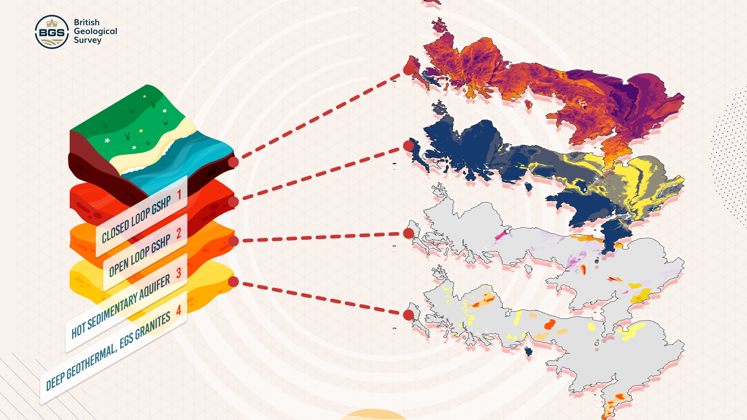
A new interactive map has been launched to help identify areas in the UK in which geothermal energy could be tapped effectively.
The UK Geothermal Platform has been developed by the British Geological Survey (BGS) and is presented in a simple to explore map-based format, offering both national and local-scale information about the underground conditions needed for different geothermal technologies.

Users can examine the potential for four types of geothermal systems, ranging from shallow closed-loop systems that work with ground-source heat pumps to deep geothermal sources in aquifers or granite formations.
Shallow, vertical closed-loop with ground-source heat pump: Long pipes are drilled vertically into the ground (in this case up to around 150m), and a fluid circulates through them in a closed circuit. The ground temperature stays relatively constant year-round, so in winter the system pulls heat from the ground to warm buildings, and in summer it can reverse to provide cooling. Because the loop is closed, nothing is taken from the ground except heat, and no water or gas is injected or removed.
Shallow open-loop with ground-source heat pump: Instead of sealed pipes, it uses groundwater directly. Water is pumped from an aquifer, its heat is extracted via a heat pump, and then the cooled water is discharged back into the ground. This method can deliver more heat than a closed-loop system, but it needs suitable geology, clean water, and careful regulation to avoid environmental issues.
Deep, hot sedimentary aquifers (hydrothermal): Wells are drilled into porous rock formations, often hundreds or even thousands of metres underground, to bring that water to the surface, its heat is transferred to a secondary system and then the cooled water is injected back underground. These systems work best in areas where there’s already naturally warm water trapped in the rock, and they can provide steady, large-scale heating for entire districts.
Deep, engineered geothermal systems in granites (petrothermal): Water is injected into fractures in hot, dry rock to absorb heat before being pumped back to the surface. This is more technically challenging and expensive but can tap into very high temperatures deep in the Earth. It’s essentially creating an artificial geothermal reservoir.
By using the platform, planners, developers, regulators and researchers can quickly assess whether new developments, urban areas, or industrial zones could use geothermal energy.
This should prove valuable both for retrofitting existing infrastructure and for integrating geothermal power into projects right from the start, as in the case of the Liverpool–Manchester–Leeds–Sheffield growth corridor.
Funded by the Department for Energy Security and Net Zero and maintained by BGS, this first release of the platform aims to open up geothermal opportunities to a wide range of stakeholders, making the UK’s transition to cleaner energy more informed and strategic.
Dr Alison Monaghan, head of geothermal at BGS, said: ‘For the first time, the UK Geothermal Platform makes a large volume of national-scale geothermal data and information available and digitally accessible.
‘It supports a wide range of users in understanding at high level the potential for a range of geothermal energy options, supporting decarbonisation of heating and energy security.’
The map can be accessed here.
Above image: Contains OS data © Crown Copyright and database right 2025, data © Department for Energy Security and Net Zero, 2025, data BGS © UKRI 2025.


Leave a Reply